Scafell Pike Hike from Wasdale Head
|
|
Where: Scafell Pike Hike from Wasdale Head
in the west of the Lake District of
England
When: June 2014
Weather: Sunny
Height: 3,209ft /978m
There are two main routes for the hikes to
Scafell Pike, one from Seathwaite Farm by
Borrowdale in the north, and the other from
Wasdale Head in the west. This Wasdale route
to the mountain is slightly shorter, but
mainly steeper.
The Wasdale Head route is normaly used by
hikers traveling up from the south, as it is
a long way round from the north, 50 miles
west of the M6 by Kendal.
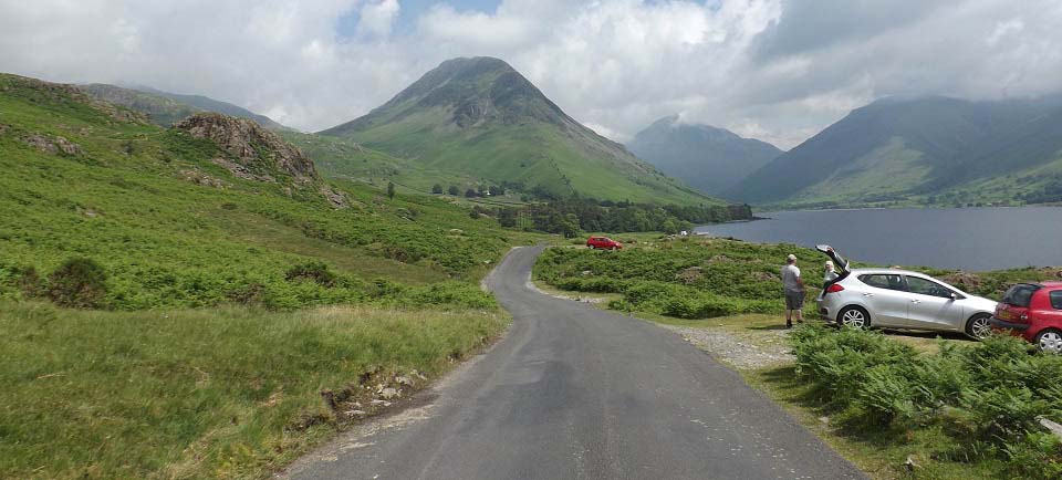
The image below is of the road running up
beside the lake named Wast Water, with
Scafell Pike mountain over to the right in
the clouds. This is a great scenic lake with
few trees to obscure your view, unlike most
other lakes in England now.
Kendal to Wasdale Head Road Map
|
|
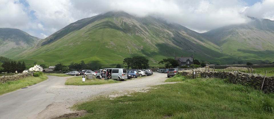
The image below is of the hiking car park
for Scafell Pike at Wasdale Head, with the
Wasdale Head Inn up
to the left, the road ends at the inn. The
inn has a camp site, and the larger National Trust
campsite is a few hundred yards back down
the road, at the north end of Wast Water.
This image was taken from the start of the
main Scafell Pike trail, about 240ft above
sea level.
|
|
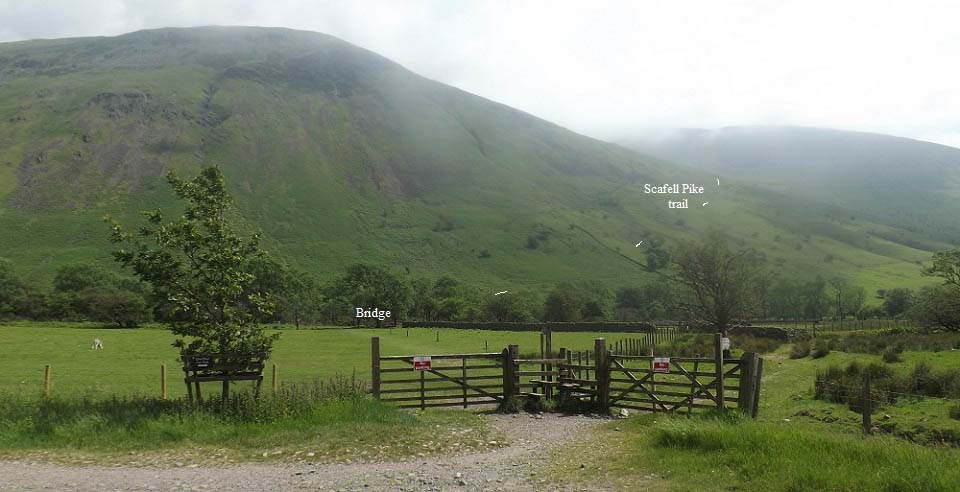
The image below is of the start of the
main Scafell Pike hiking route from Wadale
Head, about 100 yards south of the main car
park. The style leading to the right leads to
the National Trust campsite. The style
straight ahead leads across the field to the
bridge for the main trail.
The main trail to Scafel Pike leads up to
the right and around the foot of the 2,647ft
Lingmell, a good easy start to the hike.
|
|
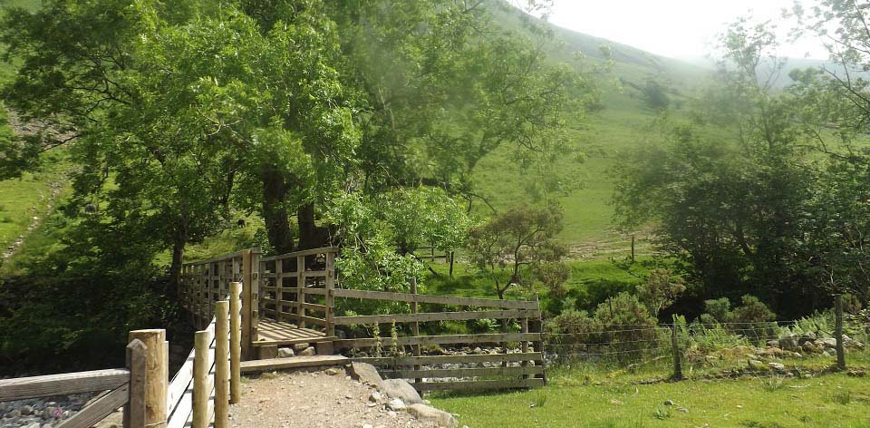
The image below is from the hiking bridge
across the stream. This was a long dry spell,
so not a drop of water in the stream,
probably a rare event in the Lake
District.
|
|
The image below is after hiking up and
around the base of Lingmell, where the main
trail meets the National Trust campsite
trail, at about 700ft
The trail from here follows the burn much
of the way. This is the steepest section up
to about 1,800ft, so about 1,100ft of tough
hiking.
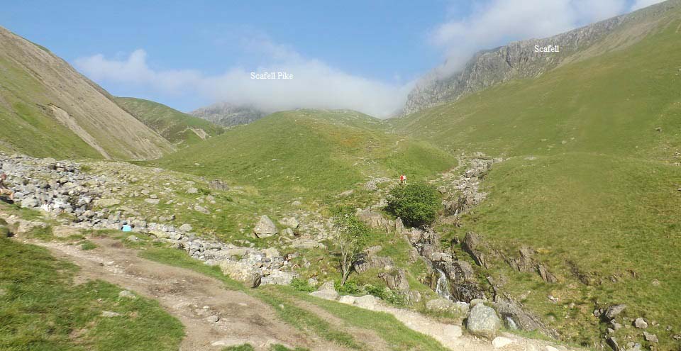
Scafell Pike is in the cloud up there, not
sure if you can actually see the top from
here when there is no cloud, as it sits back
behind the cliffs that you can see.
I had lunch at the hotel and was only
meaning to hike up to here to get this image,
but there was thick cloud from about 1,500ft,
so decided to hike up a bit further. This
image was actually taken on the road back
down.
Large
Image
|
|
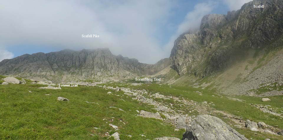
The image below is from about 1,800ft, at
the top of the steep section. The trail
splits into two here. The main trail runs off
to the left and up around the cliffs. The
trail straight ahead leads up through the
cliffs, where there is a scrambling trail at
the lowest point.
This image was also taken on the road back
down, as on the road up, the cloud was so
thick, it was even hard to follow the trail
round to the left. There are a number of
small trails that lead round to the left,
then merge into one main trail further up. I
ended up following the trail straight up, as
it was easier to follow in the cloud.
Large
Image
|
|
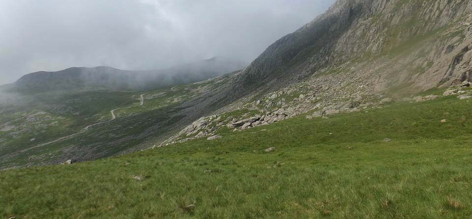
The image below is from the trail that
leads straight up, looking over to the main
trail that winds steadily up around the
cliffs. The cloud lifted for a bit here,
allowing this view across.
|
|
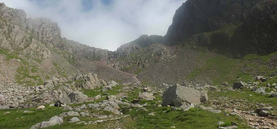
The image below is nearing the top of the
direct route. The cloud lifted for a spell
allowing a good view of the trail. It is a
steep hiking trail up here, then a bit of
scrambling close to the top, taking you up to
about 2,780ft. Turn left at the top there,
then it is about 400ft to the Summit of
Scafell Pike.
|
|
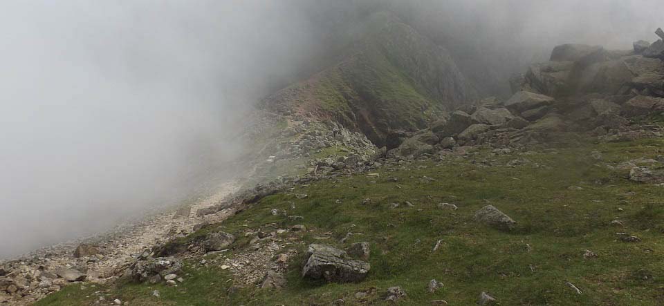
The image below is from the trail leading
to Scafell Pike summit, looking back down at
the top of the scrambling section, definately
not a route I intended going back down.
You cannot hike straight across there to
Englands second highest mountain, the 3,162ft
Scafell, as there is dangerous rock climbing
on that route. You have to hike down into the
valley on the left, then up around the worst
of the cliffs further round.
|
|
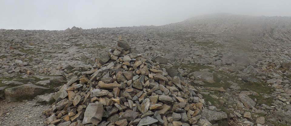
The image below is from the trail close to
the top. Most of the time it will be thick
cloud up here, so you have to follow the
cairns to the top.
|
|
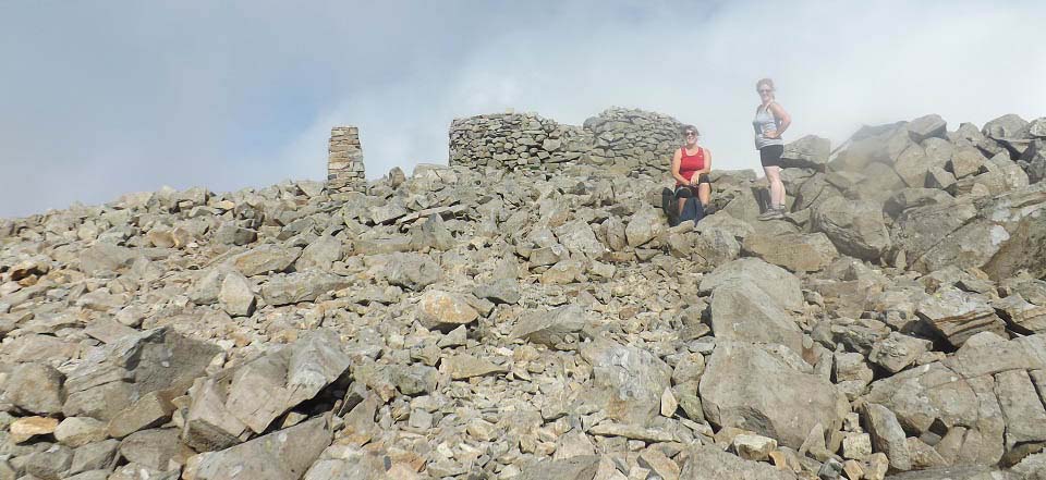
The image below is of Scafell Pike Summit
when the sun hit the top for a few minutes.
The two Welsh women here passed me going up
through the scrambling section.
The cloud meant there were no photo
opertunities of the mountains around, so it
was have a quick snack, then head back down
the main trail before the cloud thickened
again. I did notice on the route back down,
the top section of the main trail seemed
fairly steep, so not much easier than the
direct route.
|
|
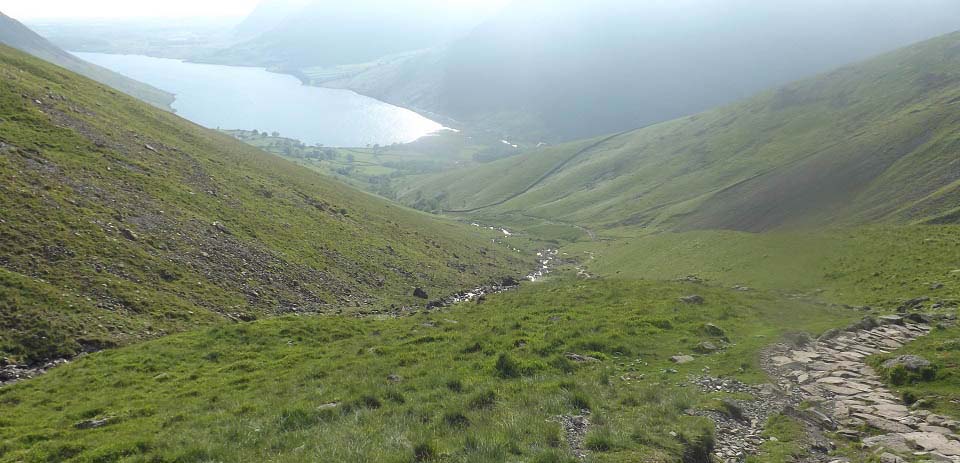
The image below is from the steep section
back down with Wast Water down there. This
image shows just how steep this section is,
and with it being well protected, there was
little or no wind, a real tough section in a
warm humid day.
|
|
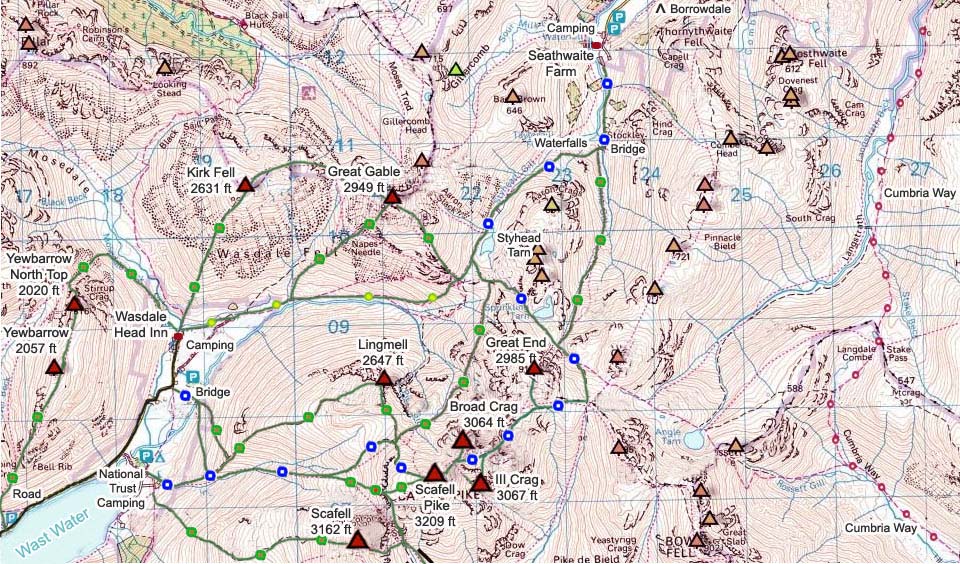
The Scafell Pike Map below shows many of
the routes onto the mountains. There are a
number of mountains in the area for hiking,
and trails going in every direction. Best
take a good detailed map with you, and a
compass, as in low cloud, it would be really
easy to get lost.
The blue and white dots are the main
trails, green and brown tougher trails, and
green and yellow easy routes. Green and red
are scrambling sections.
Crossing from Scafell Pike to the second
highest mountain in England, the 3,162ft
Scafell, requires a hike down into the valley
and up round the cliffs. The direct route
across requires a fair amount of dangerous
rock climbing.
Large Detailed
Map
|
|
This was a scenic hike with great views of
many mountains all around. The bottom section
was easy hiking, second section real tough
hiking, third section up through the
scrambling area was tough, and final section
was a steady hike to the top.
I had hiked up from the north the day
before, but cannot decide which is the
toughest way up, as this Wasdale Head route
from the west is shorter, but steadily steep
almost all the way. The north route from
Borrowdale has a couple of easy sections in
the middle, but a tough start and final
section.
Make sure and take an Ordnance Survey Map
and Compass on these hikes, and know how to
use them, as in cloud, these mountains can be
deadly. In Winter, make sure you have
Crampons and an Ice Axe, and know how to use
them.
Photo Tour of the hike from
Borrowdale.
|
|
|

