|
A list of Keswick Walking routes with Photos and
links to Maps and Guides.
Many walkers at Keswick use the buses as they
often allow more variation to the walk. The Keswick
Bus Station is in the centre of town next to the
large Booths Store.
Google Keswick Bus
Stops, Bus Numbers and Routes.
Handy numbers to have are for Davies Taxis Tel: 01768 772 676. This
company provides pick up and drop off services for
walkers and dogs.
Click on the Maps for Directions.
The Keswick Walking routes are listed by closest
to Keswick.
|

Cumbria Way South
The
70 mile Cumbria Way runs right through Keswick. You
can follow the South Trail from Keswick centre,
around the top of Derwentwater to the small village
of Portinscale, down the west side of Derwentwater,
and round the south side to the large Lodore Falls Hotel
with a beer garden, about 7 miles in distance. There
is a pier by the Lodore Falls Hotel where you can
catch a boat back to Keswick, and regular buses run
from the hotel to Keswick. You can also start the
walk with a scenic boat trip from Keswick Launch
across the lake to Portinscale. The website below has
a map of the route.
Website . OS Map . Image
|

Cumbria Way North
The Cumbria Way Trail North goes out of Keswick east
side at Brundholme Road, crosses the A66 via a
footbridge, climbs up and around Latrigg Hill to the
top hiking car park for Skiddaw mountain at 950ft.
The trail then leads up the valley between the
3,054ft Skiddaw and the 2,848ft Blencathra mountains
to Skiddaw House. The Cumbria Way trail then leads
north to the village of Caldbeck, about 14 miles
altogether. Alternatively, you can follow another
trail from Skiddaw House, round the north side of
Skiddaw mountain to the scenic village of
Bassenthwaite, from where you can catch a bus back to
Keswick, about 6 miles between Bassenthwaite and
Keswick. The website below has a map of the
routes.
Website . OS Map . Image
|

Castlerigg Stone
Circle
1 and a half miles east of Keswick. This walk starts
from Keswick centre, or there is a car park close to
the stone circle. The circle is thought to have been
constructed around 3200 BC. Use the Google Map Link
and change to walking for the route out from
Keswick.
Wiki Page . Road Map
|

Ashness Bridge
3 miles south of Keswick. Ashness Bridge is said to
be one of the most photographed sights in the lake
district. There are a number of walking trails at the
bridge, around, or up to the top of the 1,935ft
Castlerigg Fell, and the 1,994ft High Seat. There is
a large tourist car park by the bridge. Buses drop
off at start of the hill road up to the bridge, about
half of a mile walk. There is also a trail between
Keswick and the Ashness Bridge that runs along the
side of Castlerigg Fell.
Website . OS Map . Google Map
|

Dodd Wood
4 miles north of Keswick by Bassenthwaite Lake. A
visitor centre with the Old Sawmill Cafe, walking
trails, and in the spring, the Bassenthwaite Ospreys
can be watched from viewing areas in the forest. The
Mirehouse Mansion for visits and
walks through the gardens to the lake is also here.
There are regular buses that run between Keswick and
Dodd Wood.
Website . OS Map . CA12 4QE
|

Thirlmere Reservoir
7 miles southeast of Keswick. The car parks at
Thirlmere have a bus stop and regular buses that run
between Keswick and Grasmere. There are well marked
paths along the side of the reservoir, with notice
boards showing the attractions along the paths.
Across the road is another car park under the 3,117ft
Helvellyn mountain. That car park can be used to hike
the mountain, and for trails along the bottom of the
mountain.
OS Map . Photos . Map . Image
|

Grasmere
12 miles south of Keswick. The walk from the scenic
village of Grasmere, around Grasmere Lake, is one of
the most popular and scenic in England. Many walkers
hike up onto the side of Loughrigg Fell, on the south
side of the lake, for great views over the lake to
Grasmere. There are regular buses between Keswick and
Grasmere.
Photo Tour . OS Map . Map . Image
|

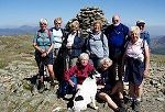
Guided Fell Walking with Cathy
and Skye
Guided walks for individuals or groups to many of the
top hiking and walking locations around Keswick, or
to less well known trails that only a local guide can
provide. Tel: 01768 774 824.
Website
|
|


